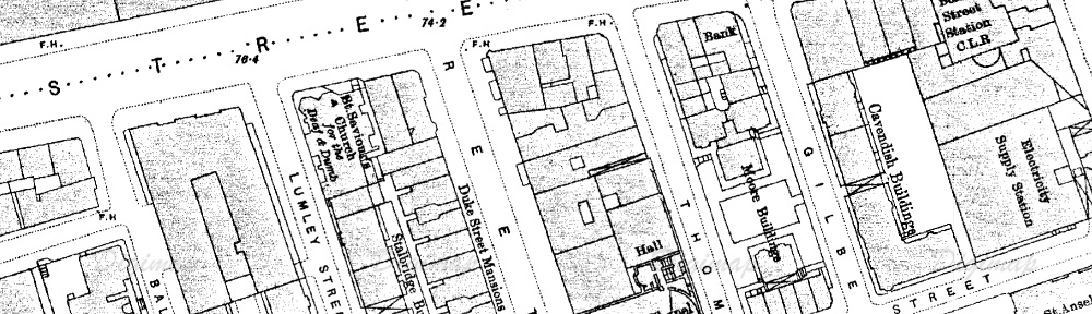
Take a look at this… it’s part of the map Oxford Street that features St Saviour’s in the 1890s. You can probably see it better in the banner for the blog.
See how the church provides a curved corner for Lumley Street? 
In pictures from the time, you can see that the church was sunk into a trench, with the downstairs floor being a good 6 feet below the pavement.
Now… here’s a photograph of the present-day Oxford Street site, where St Saviour’s used to stand.
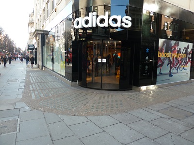
That paving, with the glass bricks in, is the actual trench that used to follow the shape of the St Saviour’s site.
We’re going to ask the Adidas store if we can go into their basement and take a look!